Innovation is at the heart of the SmartShape solution. With the integration of LiDAR HD data, our platform continues to push the boundaries of processing and visualizing massive datasets. Today, we are proud to present a major breakthrough: the display of data from the DAL of Paris and its suburbs, an impressive volume of 1.7 TB of geospatial data, seamlessly integrated into SmartShape. In this article, we will explore this technical achievement, which illustrates our commitment to transforming complex data into simple and powerful tools.
The LiDAR HD Project: A Technological Revolution
LiDAR HD (Light Detection and Ranging) is a laser scanning technology that enables the capture of extremely precise information about the geography and physical structures of a region. The Version 1.0 of LiDAR HD presents exceptional characteristics:
- Planimetric accuracy: better than 50 cm in X and Y.
- Altimetric accuracy: better than 10 cm in Z.
- Data density: minimum of 10 pulses/m².
- Acquisition blocks: squares of 50 km x 50 km, divided into 1 km² tiles.
These raw data are then processed to include detailed attributes such as geometric coordinates (X, Y, Z), signal intensity, and point classes that allow for the distinction between the ground, buildings, vegetation, and even water.
The LiDAR HD project aims to capture geospatial information with unmatched precision and density, covering vast areas such as metropolitan France, Réunion, and the Antilles. The DAL of Paris and its suburbs, now integrated into SmartShape, is a concrete example of this.
The Technical Achievement of SmartShape: Managing 1.7 TB of Data
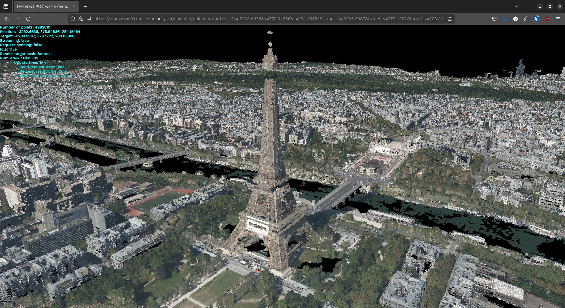
One of the biggest challenges we faced in this project was managing the enormous volume of data. The DAL of Paris represents 2 TB, and contains 25 GB of orthophotos to colorize the LiDAR HD tiles. These data are composed of over 74 billion geospatial points.
Thanks to our advanced technology, we were able to process this data with incredible efficiency, while ensuring smooth display on SmartShape. This process requires approximately 30 GB of RAM for file processing, but once everything is in place, the display of models in a web browser or on mobile is remarkably fluid.
Practical Applications: Real-Time Usable Data
The display of LiDAR data in SmartShape is not just a technical feat; it’s a revolution in how geospatial data can be utilized daily across various sectors. Whether in the naval, military, or energy industries, the ability to visualize complex environments in real-time enables better decision-making, intervention planning, and even infrastructure management.
The DAL of Paris, for example, was ready to be fully visualized in just 3 hours and 30 minutes and could be partially visualized with a lower level of detail only after a few minutes, showcasing the efficiency of data processing and rapid integration. Operators can now navigate through these complex geospatial datasets, visualize them in real-time, and even link them to other data sources (photogrammetry, sensors, etc.) for advanced analysis.
Video Demonstration: Discover SmartShape in Action
To showcase these technological advancements, we have prepared a demonstration video. This video walks you through the display of LiDAR HD data in SmartShape, illustrating how our solution handles massive data volumes while offering a smooth and intuitive user experience.
In the video, you will see:
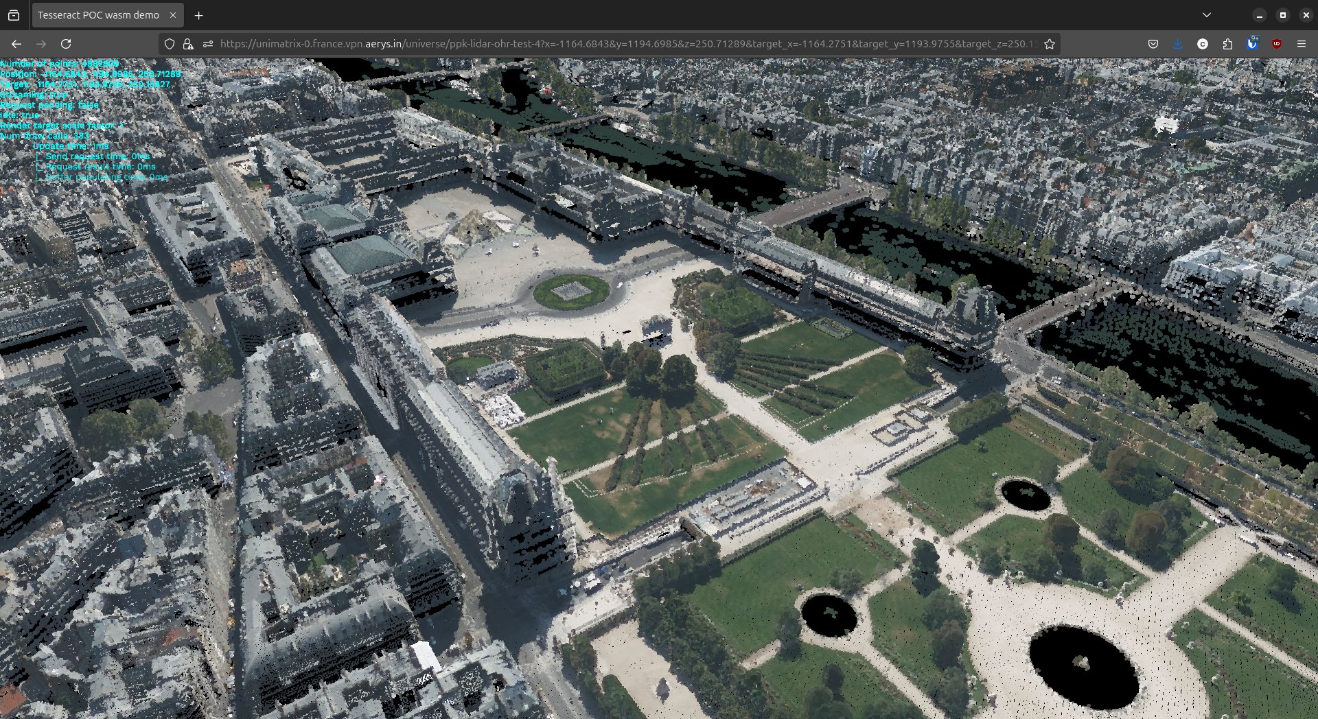
- The display of 3D models generated from LiDAR data.
- The incredible precision of the geometric and altimetric data.
- SmartShape’s ability to offer fluid navigation through these complex environments, even from a simple web browser.
Conclusion: Innovation Continues with SmartShape
The integration of LiDAR HD data into SmartShape is just the beginning. We continue to innovate, making complex data more accessible and usable in interactive and collaborative 3D environments. Whether you’re in Industry 4.0, defense, or energy, SmartShape allows you to visualize and analyze massive datasets with unprecedented precision, while facilitating decision-making.
Better understand the possibilities of SmartShape?
Schedule a demo